CROSSINN - Cross-valley flow in the Inn Valley investigated by dual-Doppler lidar measurements
- Contact:
Dr. B. Adler
- Project Group:
Land Surfaces and Boundary Layer
- Funding:
DFG
- Startdate:
2018
- Enddate:
2021
This project addresses an unsolved problem in boundary-layer meteorology with a novel approach: by performing state-of-the-art dual-Doppler lidar measurements in a vertical plain in cross-valley direction, it is intended to measure the kinematic flow structure across the whole valley cross section with high spatio-temporal resolution. Although cross-valley flows are expected to play an important role for the evolution of the atmospheric boundary layer and the earth-atmosphere exchange over mountainous terrain, our understanding of their spatio-temporal characteristics is still incomplete – mainly due to the lack of suitable observational data. Different cross-valley flow patterns are reported – mainly based on numerical simulation and few observational case studies. No studies exist so far where the kinematic structure across the whole valley cross section is observed with the high spatio-temporal resolution required to capture processes ranging from the micro-β to meso-γ scale (i.e. from a few tens of meters to a few tens of kilometers). However, these are the scales which are relevant for cross-valley flow. The novel dual Doppler technique now allows detecting processes occurring on these scales. The required sophisticated scan strategies have been successfully tested during measurement in the Neckar Valley near Stuttgart during the [UC]2 - Urban Climate Under Change project (http://www.imk-tro.kit.edu/english/2571_7176.php). By adding profile information from radiosonde and microwave radiometer measurements the impact of cross-valley flow on the thermodynamic ABL structure will be additionally assessed. The measurement will be conducted with parts of the mobile integrated atmospheric observation system KITcube (http://www.imk-tro.kit.edu/english/4635.php). The fundamental information gained from the measurements are invaluable for all numerical studies which deal with earth-atmosphere exchange over mountainous terrain and can also assist in future observational studies to optimize measurement strategies.
|
|
|
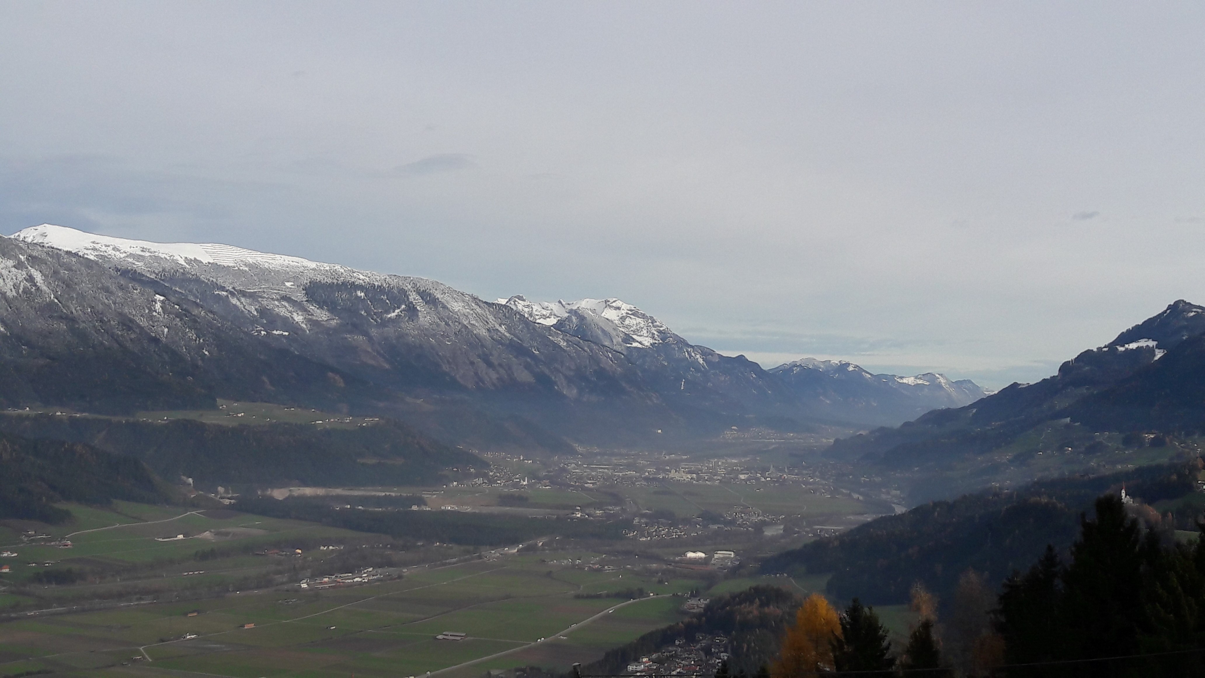
Fig. 1: Investigation area in the Inn Valley near Innsbruck. |
|
|
|
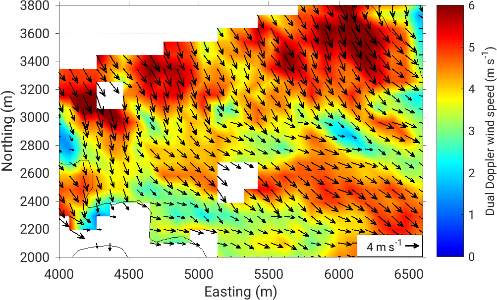
Fig. 2: Spatial distribution of horizontal wind in the Neckar Valley derived with dual-Doppler lidar measurements. The large spatial variability of the wind field is clearly visible. |