Monsoon Processes
Overview:
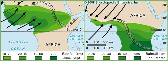
Southern West Africa’s climate is strongly affected by the West African monsoon system. The monsoon brings seasonal rains to the region, and is therefore essential to the livelihoods of millions. The monsoon flow is driven by the low-level pressure gradient between higher pressure over the relatively cool waters of the tropical Atlantic and the Saharan heat low. In common with most tropical continental regions, there are substantial errors in the West African monsoon region in global weather, seasonal and climate models. For example, many analyses unrealistically show West Africa as a moisture source rather than a sink during the summer and models generally do not make useful seasonal predictions in the Sahel. There are significant inter-model variations in climate projections of the West Africa monsoon making it difficult to predict the impacts of climate change and to develop adaption strategies. Although some progress has been made in recent years, there are well-known model errors remaining, such as those associated with radiative forcing in the heat low region over the Sahara, the representation of deep convection in the Sahel and air-sea interactions over the equatorial cold tongue in the Gulf of Guinea. The role of aerosols, clouds and precipitation over southern West Africa for the monsoon system has been investigated very little and will be one focus of this Work package. This way WP7 analyzes the upscale impact of processes studied in other DACCIWA work packages on the regional scale circulation.
Science Activities:
Objectives
1. Data digitization
The lack of a dense network of long-term observations is an important obstacle in climate and weather research in West Africa. WP7 works closely with West African weather service to digitize historical data only available on paper. The obtained data are ingested into the specially designed Karlsruhe African Surface Station Database (KASS-D) and can be made available to other researchers. This way WP7 contributes considerably to the surface-based component of the DACCIWA climatological dataset.
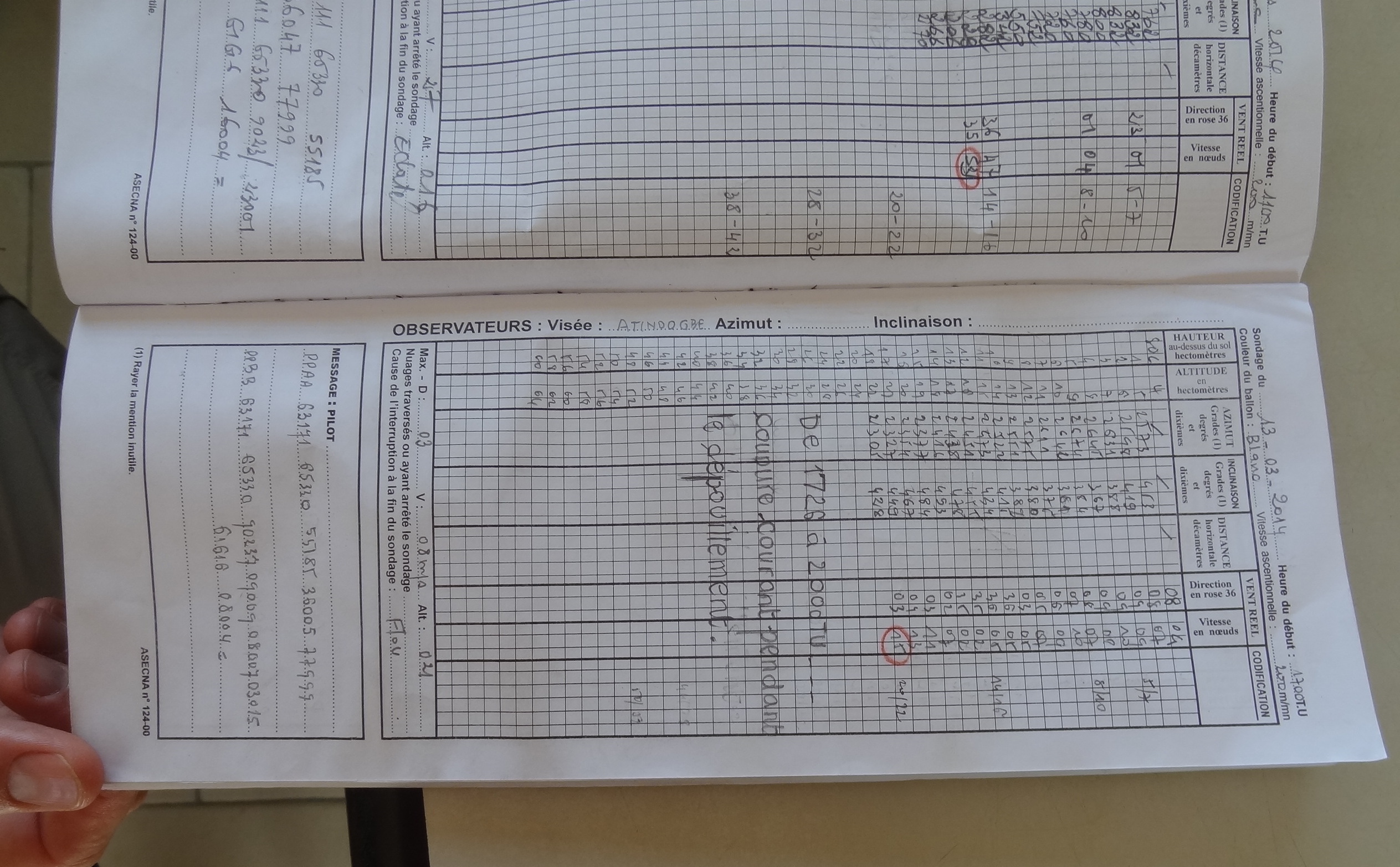
FIG 1: Hand-written weather record from Benin (photo: Andreas H. Fink, KIT).
2. Weather forecasting for the DACCIWA campaign
For the planning of research flights and ground-based observations during the main campaign in June-July 2016, weather forecasts tailored to the needs of DACCIWA researchers were key. WP7 used a dedicated webpage (http://dacciwa.sedoo.fr/) to provide a wide range of forecast products from a number of different models and forecast centers, including the DACCIWA beneficiaries ECMWF and UK MetOffice. Now that the campaign is over we are in the process of carefully evaluating these forecasts with the data collected during the campaign and those from conventional platforms (surface stations, satellites).
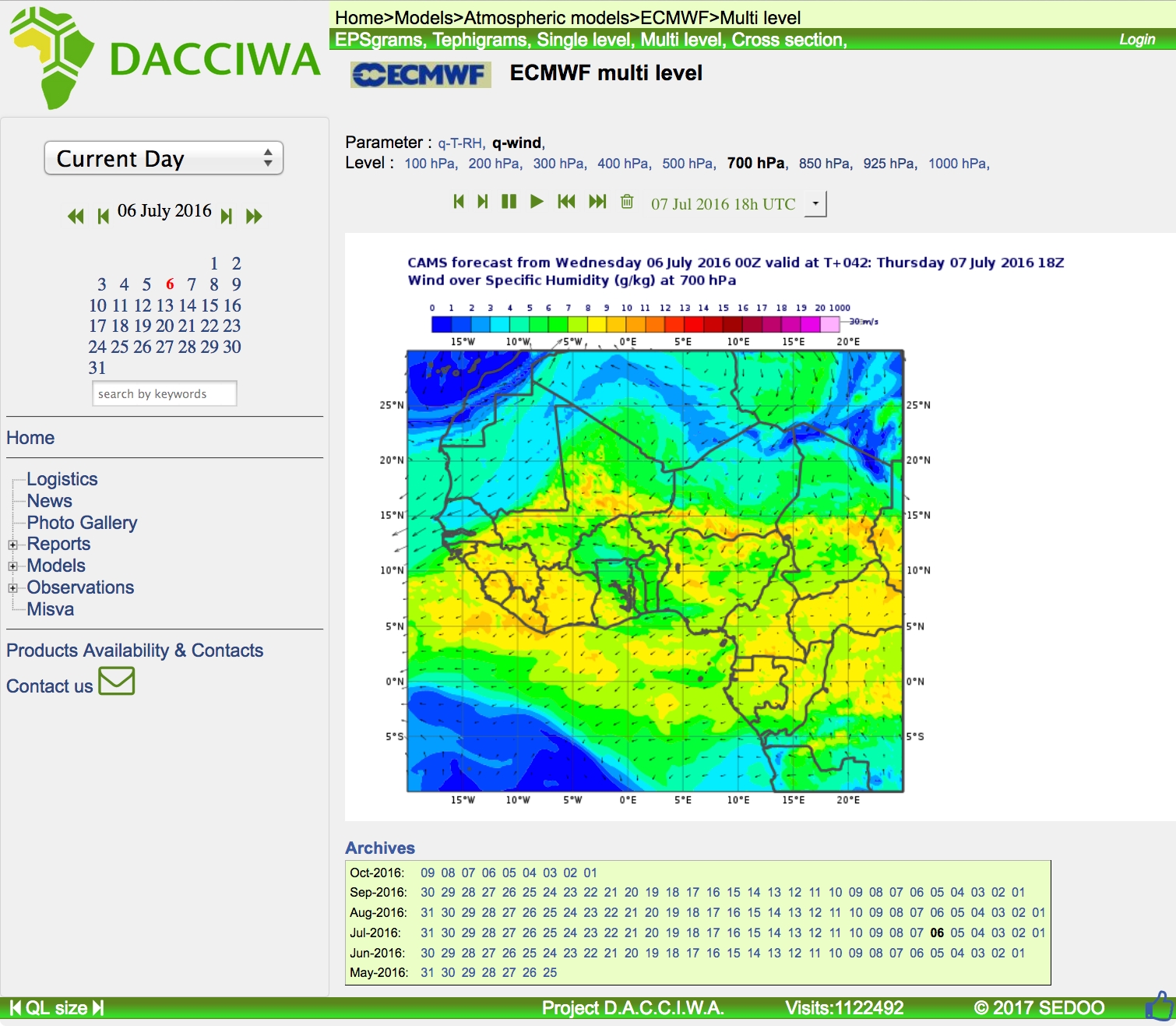
FIG 2: Example of a forecast plot used during the DACCIWA field campaign in June-July 2016. Shown is a
42-hour prediction of winds and humidity at about 3km above ground from ECMWF.
3. Evaluation of climate models
As stated above, many climate models struggle to realistically reproduce the West African monsoon. In WP7 we evaluate those models with a specific focus on southern West Africa, where low-level clouds play an important role in the diurnal cycle. First results reveal that reproducing this diurnal cycle and the correct amount of low clouds is in fact a substantial challenge for state-of-the-art climate models.
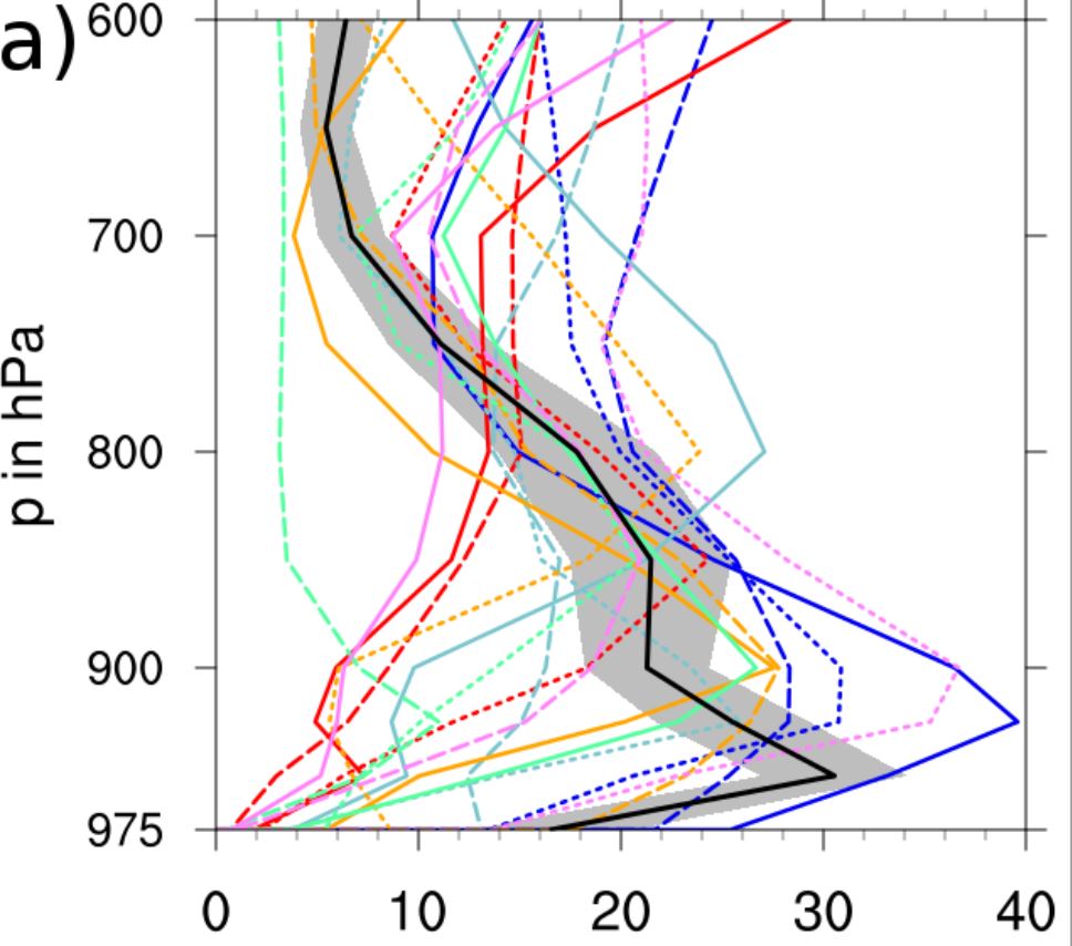
FIG 3: Vertical profile of cloud cover from IPCC climate models (coloured lines) and ECMWF ERA-Interim re-analysis (black line with grey monthly standard deviation). All data are averaged spatially over 8°W–8°E, 5–10°N and temporally over July–September 1979–2008. (Figure 2a from Hannak et al. 2016, Journal of Climate).
4. Sensitivity studies with regional and global models
Given the substantial problems many weather and climate models show over West Africa, it is important to test the sensitivity of model results to the representation of boundary-layer processes, low-level clouds, precipitation and radiation over the DACCIWA study area. An example for such a test is a model simulation where low clouds are artificially made transparent to assess their impact on the surface energy balance and diurnal evolution of the atmospheric boundary layer.
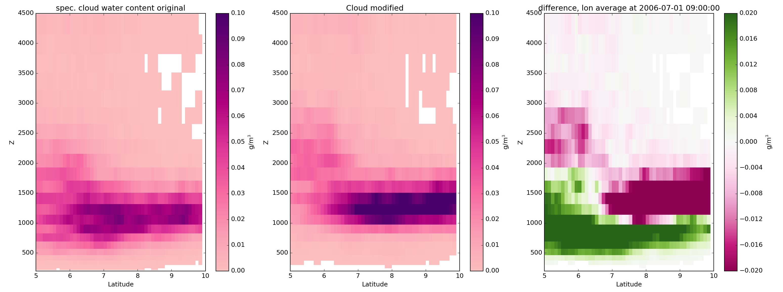
FIG. 4: Sensitivity experiment using the global ICON model, where low clouds (below 850 hPa) were artificially made transparent to test their influence on the evolution of the boundary layer, i.e. the optical thickness of the clouds was reduced to 10% of its original value. In the figure, zonal mean specific cloud water content at 09 UTC is shown for the control simulation (left), the transparent-cloud experiment (middle) and the absolute difference (right) based on the respective average diurnal cycles for July 2006. Evidently, solar heating has a greater effect for the transparent clouds, as the cloud deck dissolves quicker and lifts higher after sunrise than the original clouds. The lower levels dry more quickly due to the enhanced heating. The quicker lifting also causes enhanced cloud water.
Aerosols interact with the climate system via the direct, semi-direct, and indirect aerosol effect. Due to urbanization and population growth, anthropogenic aerosols are becoming more important in southern West Africa. To get an understanding of the role of aerosols in the West African Monsoon system we perform simulations with the global aerosol – climate model ECHAM6-HAM2. Emission inventories are crucial to prescribe anthropogenic aerosol emissions in the model, but available inventories differ a lot over Africa. Therefore, we compare simulations using different inventories (including the one developed as part of WP2).
5. Future scenarios
Climate simulations using the ECHAM6-HAM2 model are being run to assess potential changes to the West African monsoon due to future changes in regional anthropogenic emissions, land use and global climate. This will include using different African emission inventories developed as part of Work Package 2. These simulations will be based upon CMIP5 simulations of the earth system model MPI-ESM-LR.
6. Recommendations
Towards the end of the project we will evaluate our findings from the various model evaluation activities to derive concrete recommendations for potential model improvement that we will share with operational centres. We will also reflect upon socio-economic implications of possible future changes and integrate those into DACCIWA policy briefs.
Significant results and achievements
- Ingestion of first data from digitisation of West African surface station observations into the Karlsruhe African Surface Station Database (KASS-D), which allows a quick and comfortable access to these data.
- Provision of tailored forecast products from a range of operational centres and own modelling activities for the DACCIWA field campaign in June-July 2016 through the dacciwa.sedoo.fr and other web resources.
- Development of a detailed “evaluation protocol” for the field campaign forecasts.
- Extensive evaluation of existing climate model output from the CMIP5 and Year of Tropical Convection datasets, including aspects as the diurnal cycle and contributions from individual model parameterisations to tendencies of temperature and moisture (Hannak et al. 2016).
- Climate models show substantial biases in low-level cloud cover and wind. While nighttime tendencies of temperature and moisture are relatively consistent, daytime behaviour varies widely with many models showing too low cloud cover, too much incoming solar radiation associated with too low relative humidities near the surface.
- Set up of experiments and first simulations with a range of climate, seasonal and weather prediction systems to analyse mean model behaviour and sensitivities.
Models:
MO and ECMWF, ECHAM6-HAMMOZ
Project Lead:
Germany
Other Partners:
- ECMWF
- ETH Zurich
- KNUST
- OAU
- MO