Cloud-Aerosol Interactions
Overview:
Clouds efficiently scatter solar radiation to space and so play an important role in regulating surface heating and determine rainfall distributions across the planet. Knowledge of clouds across the West African region is poor, due in large part because of a lack of measurements to inform, constrain and improve model predictions. Satellite data show that during the West African monsoon in June and July low level stratus clouds that develop during the night are pervasive across the region. During the day, solar heating causes a transition to cumulus clouds that is initiated closer to the coast and progressing inland. There is considerable day to day variability and this behaviour has, to date, not been well replicated in models.The problem is further complicated since cloud properties are influenced by aerosol particles, which act as sites onto which water condenses when a cloud forms. The greater the number of aerosol particles, the more cloud droplets will be present in a cloud, enhancing the scatter of sunlight back to space and reducing the likelihood of the droplets growing to the size where they can coalesce and initiate rainfall. In the west African region, increasing population and rapid industrialisation are changing the composition of the atmosphere and enhancing these particles greatly. This is likely to impact cloud properties but, prediction of these changes is complex and computer models have little available data in the region against which predictions can be tested.
Objectives
The main objective of this work package is to quantify cloud microphysical and dynamical behaviour across the west African monsoon, with particular emphasis on the influence the variety of aerosol sources across the region have on stratus, cumulus and congestus clouds and their transition.The specific objectives are to:- quantify the two-way coupling between aerosols and cloud and raindrops, focusing on the distribution and characteristics of CCN, their impact on cloud characteristics and the removal of aerosol by precipitation;
- determine stratus and cumulus cloud micro- and macro-physical properties across the SWA;
- assess the skill of regional models in predicting regional cloud behaviour;
- improve the predictive capability for cloud-aerosol interactions across the region.
Significant results and achievements
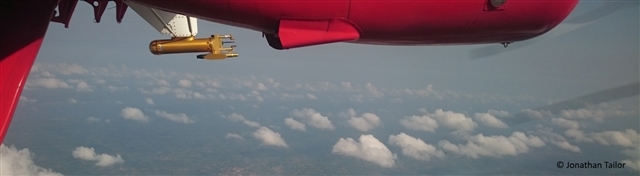
- Stratus cloud coverage was observed to be spatially highly variable across the DACCIWA region
- Multi-aircraft flights over the same stratus region through a single day show a continuous cloud deck at low level formed close to the coast with cloud tops increasing to the north, through the morning cloud top increased in depth and cloud base lifted from close to the surface. Daytime heating led to the break-up of the continuous deck and transition to scattered cumulus as the deck dissipated.
- City plumes, in particular those from Accra, showed significant influence on the cloud via increases in cloud droplet number.
- Preliminary results from COSMO-ART reveal that the onset, cloud base height, diurnal cycle and regional extent appear to be in good agreement with previous studies and data from the Save supersite. This finding couples closely to the work in WP1. The UM was run at a much higher resolution (4 km) but showed broadly similar behaviour.
- Biomass burning aerosol was shown in CHIMERE simulations to make an important additional contribution to air pollution across the region during DACCIWA in addition to the large urban regions
- Initial runs with the IFS-CAM model using a global emissions inventory show that there is a small positive influence on the direct effect from aerosol across the region. The effect of using the improved emissions dataset that is being developed in WP2 is planned to be assessed.
- Global aerosol-climate simulations using the coupled ECHAM6-HAM2 model show that the aerosol optical thickness is in reasonable agreement with measurement data but the organic carbon and sulphate are under-and over-represented respectively. The surface temperature appears to be well represented and the latitudinal location of rain is well simulated though rainfall amounts are under-estimated to the south of 10N. .
Field Activities:
The field intensive took place between 25th June and 17th July 2016 and involved all three aircraft: the ATR-42 of SAFIRE, France; the DLR Falcon; and the British Antarctic Survey Twin Otter. The aircraft intensive experiment was extremely successful and has delivered considerable data that is being used to describe the clouds across the West African region and provide data to test computer model studies of cloud systems and aerosol-cloud interactions. The 3 aircraft flew 50 missions in the period between 29th June 2016 and 16th July 2016. In total 23 flights were dedicated to aerosol-cloud interactions, amounting to 70 h of data from all 3 aircraft. Of these, 32 h were conducted on a transect between Lome and Savé, 10 h were spent in the region between Lomé and Kumasi, around 11 h of cloud sampling was carried out between Lomé and Abidjan, and around 17 h of aerosol and cloud focussed activity took place more broadly across the region.
This represents a very rich data set, by far the greatest amount of information on clouds and aerosols ever amassed across West Africa that will provide important information for studies of cloud and how they are influenced by pollution. This is particularly important in West Africa since the region is only at the start of what will be a period of huge economic and population change in the coming years and assessing how this influences the cloud system will be very important.
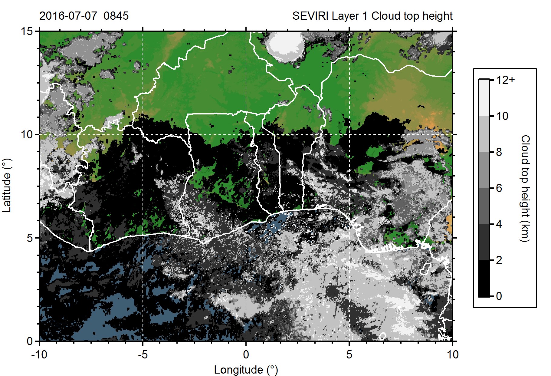
Cloud top height retrieved from the SEVIRI instrument on ENVISAT for 08:45 on 7th July 2016. Extensive low
level stratus can be seen in the dark shading across most of the West African continental region. Such extensive
stratus is observed widely across West Africa in the morning after forming overnight.
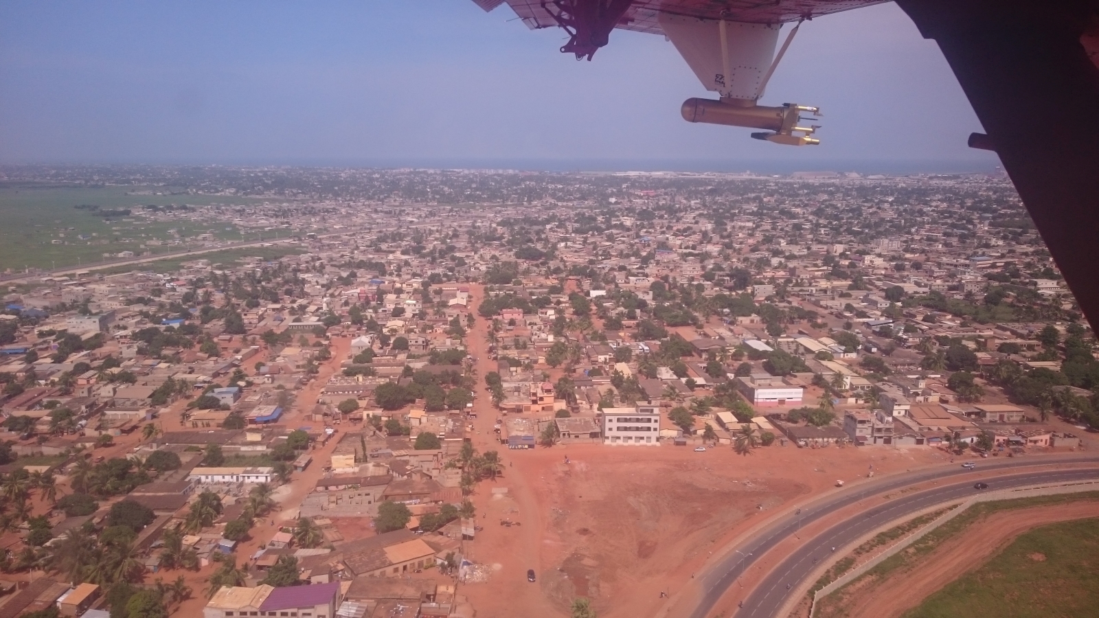
The city of Lome, home operating base for all 3 DACCIWA research aircraft.
Models:
- COSMO-ART run by KIT,
- The Unified Model (UM) run by University of Leeds
- CHIMERE run by UPMC
- ECHAM-HAM run by ETHZ,
- IFS-CAMS run by ECMWF
- The Met Office NERC Community Model (MONC) run by the University of Manchester
Project Lead:
Other Partners:
- KIT
- ETH Zurich (Tanja Stanelle)
- ECMWF (Angella Benedetti)
- UBP (Alfons Schwarzenböck)
- DLR (Hans Schlager)
- CNRS
- UPMC (Laurent Menut)
- University of Leeds (John Marsham)