Precipitative Processes
Overview:
Due to the strong continuing population growth and urbanization tendencies in Southern West Africa the demands for key socio-economic factors such as water availability, food and energy production are expected to increase for several decades to come. These factors are highly dependent on the existence of rainfall associated with the West African monsoon system, putting reliable operational rainfall forecasting into a greater focus. However, aerosol particles produced from anthropogenic emissions may play a crucial role in the spatio-temporal development of precipitation systems on a regional scale, e.g. their possible influence on the formation of a nocturnal low-level-stratus deck which ultimately controls the occurrence and timing of deep moist convection and thus the larger-scale dynamics and annual rainfall. Additionally, very little is known about which rainfall type contributes how much to the annual rainfall in such a polluted environment like the coastal region of West Africa and might differ from non-polluted areas farther inland. The capability of numerical models to simulate these multi-scale couplings and the consequent precipitation field correctly in Southern West Africa is still very uncertain. Although today's spaceborne rainfall products exhibit spatio-temporally high resolved measurements, the lack of a dense ground-based observation network in this region has set limitations to the validation process of the rainfall data and would, in consequence, limit the evaluation quality of the model's performance. Therefore, WP6 investigates (a) the (thermo-)dynamics of different classes of rainfall systems by exploiting satellite data and measurements from the DACCIWA field campaign and (b) their representation in state-to-the-art numerical models with different spatial and temporal scales.
Science Activities:
Objectives
- Re-activate as many of the four silent AMMA radiosonde stations in SWA as feasible, enhance soundings at Abidjan and suitable other locations, and coordinate all upsonde activities for the 2016 three-week IOP, and create a quality controlled DACCIWA radiosonde data base. (see also Field Activities)
- Identify rainfall types in SWA, their seasonal and diurnal cycles, and the synoptic-dynamic environment in which they develop. The importance of different types of rainfall systems for the total rainfall amount is quantified based on various satellite products available for the DACCIWA region. Further analyses of their life cycles and origins are carried out by identifying the storm path using tracking algorithms.
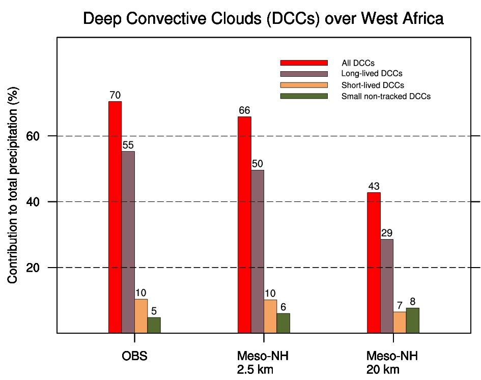
Fig. 1: Contribution of Deep Convective Clouds (DCCs) to total precipitation over West Africa between 9 and 15 June 2006 for three datasets: TRMM/MSG observations and two Meso-NH simulations at 2.5 and 20 km resolution. First results indicate the signficance of DCCs to total rainfall in both observations and model simulations.
- Evaluate satellite rainfall products with data from rain gauges and precipitation radars. Comparing satellite observations against ground-based measurements is key to assess the strengths and the weaknesses of satellite retrievals. Data from a dense rain gauge network around Kumasi (Ghana) and a precipitation radar deployed at Savé (Bénin, operated by WP1), respectively, are suitable to assess satellite rainfall products.
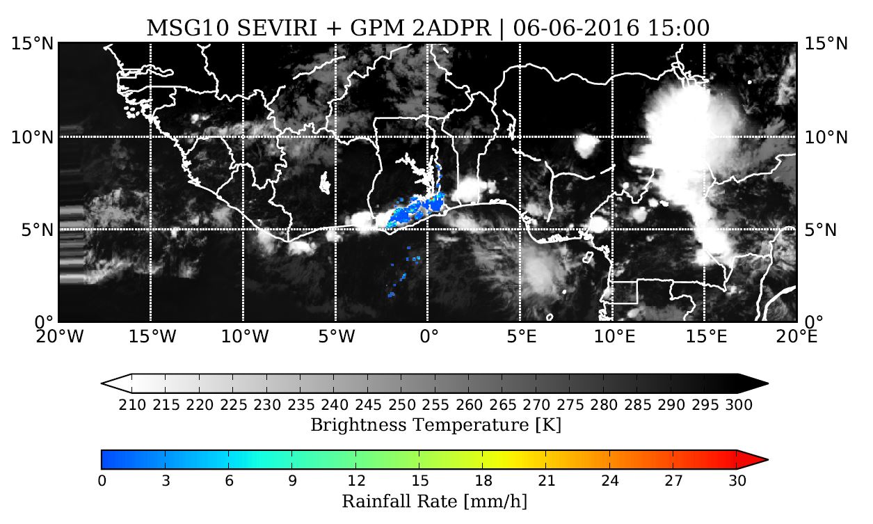
Fig 2: Brightness temperature (gray scale) and precipitation overlay (colored) from MSG10 SEVIRI and TRMM Precipitation Radar, respectively, for the 6th June 2016 at 15 UTC

- Identify meso-scale and micro-scale dynamical controls on precipitation related to Planetary Boundary Layer (PBL) development and transition from stratus to convective clouds. Both radiosonde and ground-based data, the latter provided by WP1 from Savé, will be evaluated for different rainfall cases. Furthermore, Large Eddy Simulations (LES) will be conducted to complement the investigation of the PBL evolution from the model’s perspective. Additionally, to LES runs, Weather Research and Forecasting (WRF) model simulations on a coarser but still convection permitting grid scale will be analyzed over the course of the rainy season 2016.
- Determine the relationships between aerosols, cloud dynamics, entrainment and detrainment, and the development of warm rain in warm (ice-free) layered and deeper congestus clouds and their representation in models. As in previous.
Significant results and achievements
- Successful radiosonde campaign in June-July 2016 during which about 770 radiosondes were launched at seven stations in three West African countries
- Radiosonde data were successfully submitted into the GTS, assimilated by National Weather Services worldwide and improved the analyses at ECMWF and DWD.
- Automatic recording rain gauge network fully operational in the campaign year 2016, with 19 sites in a 100,000 km2 around Kumasi (Ghana)
- Additional rainfall data and other meteorological have been acquired from LAMTO geophysical observatory in Ivory Coast and nine stations in Togo.
- TRMM radar-based classification of rainfall types yields a significant fraction of warm rain events in terms of occurrence of rainfall at the Guinea coast, but a negligible contribution to total rainfall amount – this low contribution is currently challenged by an employing a METEOSAT Cloud Physical Property product
- At least two periods of hitherto undocumented eastward-moving rainfall systems have been discovered at Savé in July 2016 and will be diagnosed in details in collaboration with WP1.
- Six-day high-resolution MESO-NH model experiments in June 2006 confirm the overwhelming role of deep convective clouds for rainfall in southern West Africa – though the latter was assessed using satellite rainfall estimates only.
Field Activities:
Installation of Rain Gauges
One year prior to the DACCIWA field campaign in June and July 2016, a dense network of high-resolution rain gauges was established in a radius of approximately 60 km around one of the DACCIWA supersites in Kumasi (Ghana). Passing rainfall systems have been monitored on a minute basis that allows the analysis of rainfall intensity and frequency, duration, storm velocity and other characteristics. To date, valuable data from the entire year 2016 and parts of 2015 were collected. However, further efforts are undertaken to operate the rain gauge network beyond the DACCIWA year.
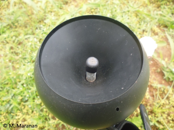
Fig 4.: View from inside of the rain gauge enclosure in Konongo (Ghana)
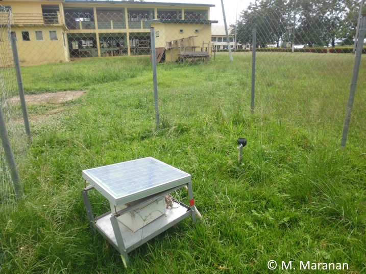
Fig 5.: Close-up onto the rain collector, showing the funnel and the filter
Radiosonde Campaign
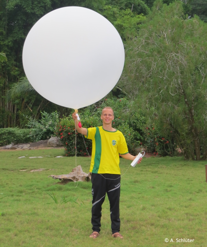
Within the two months of the field campaign more than 750 radisondes were launched at seven stations in West Africa. By deploying them at least every six hours, daytime vertical atmospheric profiles are measured as well as conditions during the night. The respective data have been made available for DACCIWA members. For the purpose of analyzing rainfall systems, these measurements will give insight in the atmospheric state prior, during, and after rainfall events that helps to better understand the physics that lead to these events. Aside from its scientific value, the radiosonde campaign provided the opportunity to involve students from African universities to work with European students to guarantee an uninterrupted sounding schedule.
Fig 6.: Moments prior to a radiosonde launch in Lamto. The radiosonde is attached to the
balloon with a cord. Altitudes of 20 km and more were reached on a regular basis.
Models:
- ECMWF
- UM
- WRF
- Meso-N
Project Lead:
Germany
Other Partners:
- University of Leeds
- University of Manchester
- UPS
- KNUST
- OAU