
HYMEX / Hydrological Cycle in the Mediterranean Experiment
- Contact:
Dr. Norbert Kalthoff, Dr. Ulrich Corsmeier, Dr. S. Khodayar
- Project Group:
IMK-TRO
Cyclones and mesoscale convective systems often cause high-impact weather in the western Mediterranean. However, it is still a great challenge to predict where and under which conditions these systems lead to high-impact weather. While the synoptic conditions of these events are relatively well known, the processes and mechanisms governing the precise location of the systems are often unclear. The complexity of orography, land use, and soil texture as well as the difficulty to characterize the initial state of soil moisture and atmospheric variables with high spatial resolution are some reasons why high-impact weather is hard to predict.
 |
 |
|
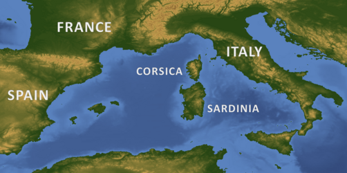
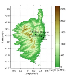
| Figure 1: Orography of the western Mediterranean region (left) and of the Corsica island (right) | ||
To improve the understanding of the Mediterranean hydrological cycle, HyMeX (HYdrological cycle in Mediterranean EXperiment) was initiated. By means of high-resolution model simulations and available observations in the region, the processes behind the initation and intensification of convective systems resulting in heavy precipitation events with catastrophic consequences are investigated with particular focus on the relation to atmospheric water-vapor distribution.
Within the HyMeX measurement network, the Karlsruhe observatory for convection studies (KITcube) was installed on the Corsican Island. This position allowed to monitor the conditions in the pre-convective environment of high-impact weather, to quantify the contribution of the different processes leading to high-impact weather and to investigate the influence (orographically, thermally, aerodynamically) of the Corsican Island on the initiation and evolution of single and in cyclones embedded cumulonimbi and mesocale convective systems. In addition, the distribution of the instruments over the island allowed to analyze processes which range from the turbulent to the mesoscale and which impact the water-vapor distribution and the atmospheric stratification in the pre-convective environment.
 |
 |
|
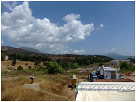
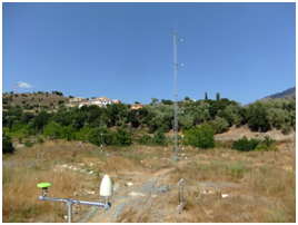
| Figure 2: Measurement site at Corte on the Corsican Island looking south-east. | Figure 3: Measurement site at Corte on the Corsican Island looking north-east. | |