
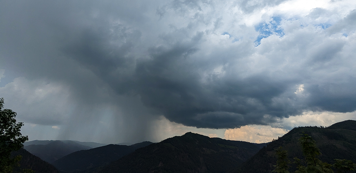
On the hunt for thunderstorms and hail....
Thanks to funding from the German Research Foundation (DFG), the IMK-TRO's Atmospheric Risks![]() working group, in cooperation with the University of Bonn and support from the Australian Bureau of Meteorology and Penn State University, is hunting thunderstorms in Baden-Württemberg this year and next. As part of the newly started project LIFT (Understanding Large Hail Formation & Trajectories), the formation of hail is being investigated, which causes considerable damage not only in southern
working group, in cooperation with the University of Bonn and support from the Australian Bureau of Meteorology and Penn State University, is hunting thunderstorms in Baden-Württemberg this year and next. As part of the newly started project LIFT (Understanding Large Hail Formation & Trajectories), the formation of hail is being investigated, which causes considerable damage not only in southern 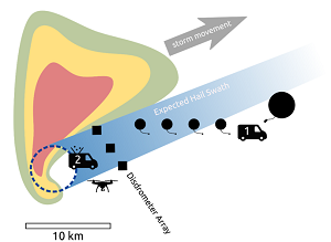 Germany (Kunz et al, 2018; Allen et al, 2020).
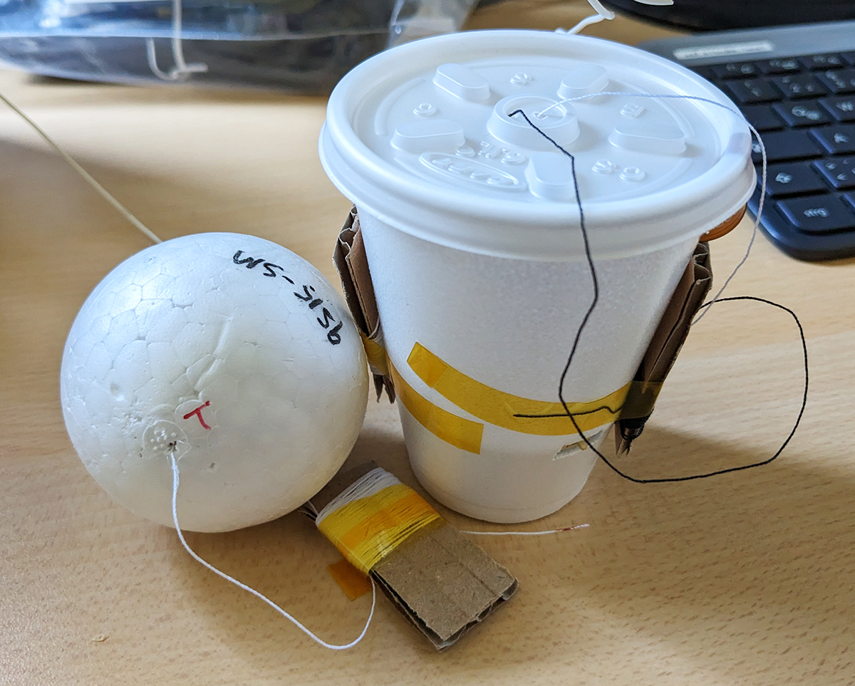
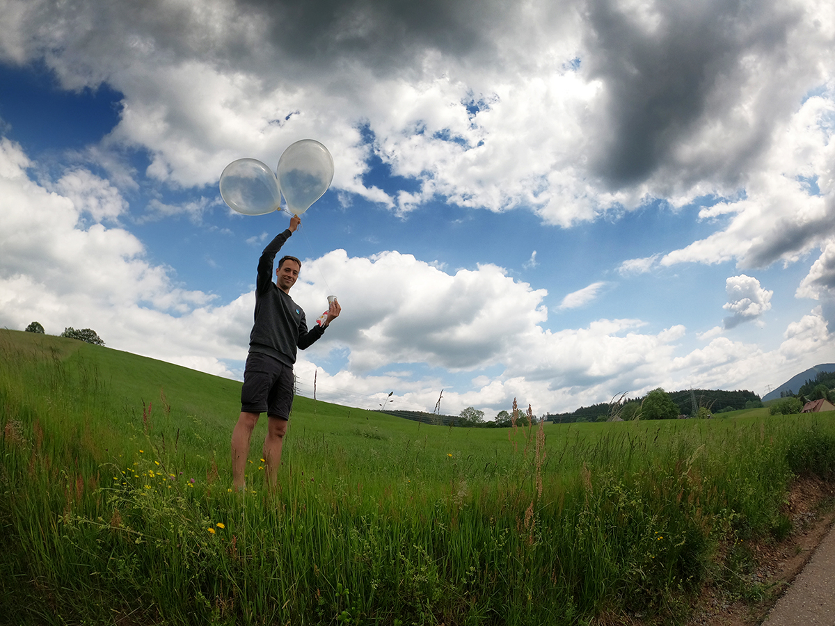
For the first time in Europe, small sondes (12 g and 26 g; see Fig. 1) are launched into thunderstorms with helium-filled balloons to trace the path of hailstones through the updrafts of the thunderstorm systems. In addition, measurements are made via drone flights along the hail tracks on the ground (cf. Soderholm et al., 2020) and hail disdrometers to measure the distribution of hail sizes and subsequently compare them with radar data. The objective is to gain a better physical understanding of hail formation and the distribution of hailstones on the ground after an event in order to improve hail prediction and possible damage estimates.
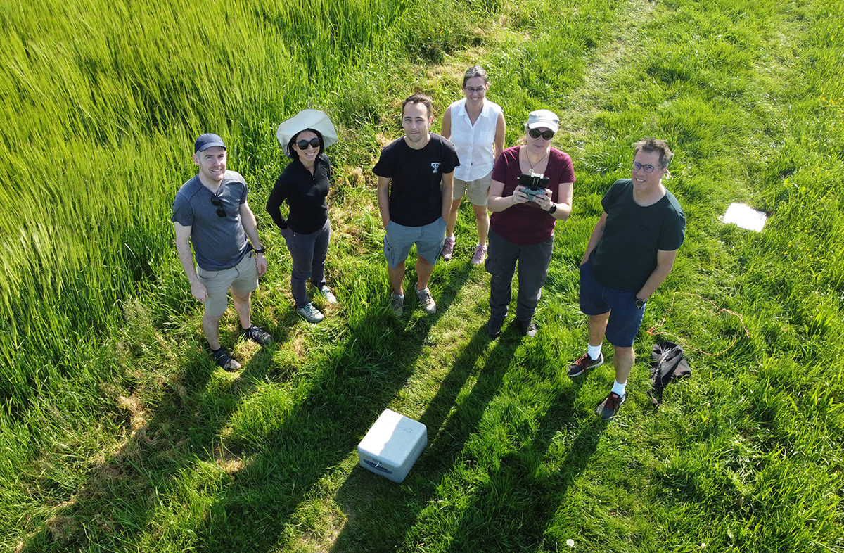
This year, the project is taking place concurrently with the Swabian MOSES measurement campaign in order to effectively use the measured data from both projects. However, at the beginning of the project, the team (Fig. 2) had to undergo a training session. We are particularly grateful for the support of our colleague Joshua Soderholm (pictured left) from the Bureau of Meteorology in Australia, who is currently assisting us with his experience with sondes and drone flights. The first tests at the beginning of June in the southern Black Forest were successful. Now we are eagerly awaiting the upcoming thunderstorm episodes.
References:
Allen, J. T., Giammanco, I. M., Kumjian, M. R., Punge, H. J., Zhang, Q., Groenemeijer, P., Kunz, M., Ortega, K. (2020): Understanding hail in the earth system, Rev. Geophys., 58 (1), e2019RG000665, doi:10.1029/2019RG000665.
Kunz, M., Blahak, U., Handwerker, J., Schmidberger, M., Punge, H. J., Mohr, S., Fluck, E., Bedka, K. M. (2018): The severe hailstorm in SW Germany on 28 July 2013: Characteristics, impacts, and meteorological conditions. Q. J. R. Meteor. Soc., 144, 231-250, doi:10.1002/qj.3197.
Soderholm, J. S., Kumjian, M. R., McCarthy, N., Maldonado, P., Wang, M. (2020): Quantifying hail size distributions from the sky – application of drone aerial photogrammetry, Atmos. Meas. Tech., 13, 747–754, doi:10.5194/amt-13-747-2020.
[Working group: Atmospheric risks]
Authors: Jannick Fischer & Susanna Mohr (June 2023)