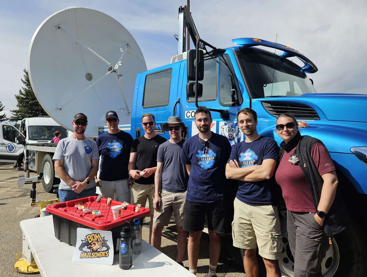
IMKTRO is participating in the international ICECHIP hail measurement campaign in the Great Plains
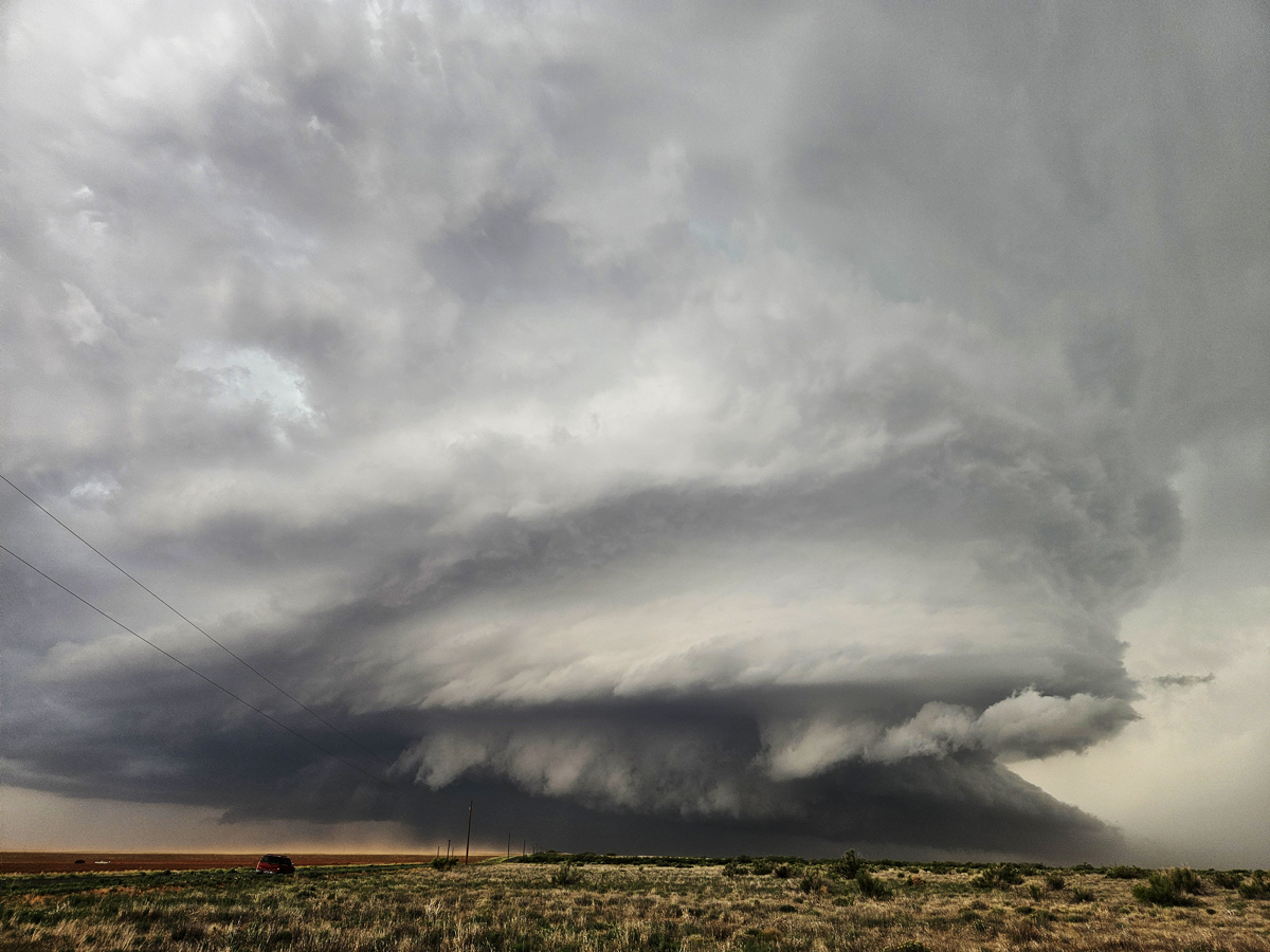
The ICECHIP (In-situ Collaborative Experiment for the Collection of Hail in the Plains) field measurement campaign is currently taking place in the Great Plains of the United States. It is the first comprehensive scientific campaign in over 40 years dedicated exclusively to the study of hail (Witze, 2025). For six weeks, dozens of researchers are tracking and analyzing hail-producing thunderstorm systems. While most participants are from the United States, international teams from Canada, Australia, China, Switzerland and Germany are also involved. The main objectives of the campaign are to improve hail detection and size determination using radar, to make corresponding forecasts, to analyze the structure of hailstones depending on the prevailing environmental conditions, and to provide reliable reference data for materials research (hail-resistant construction) in order to increase resistance to the effects of hail.
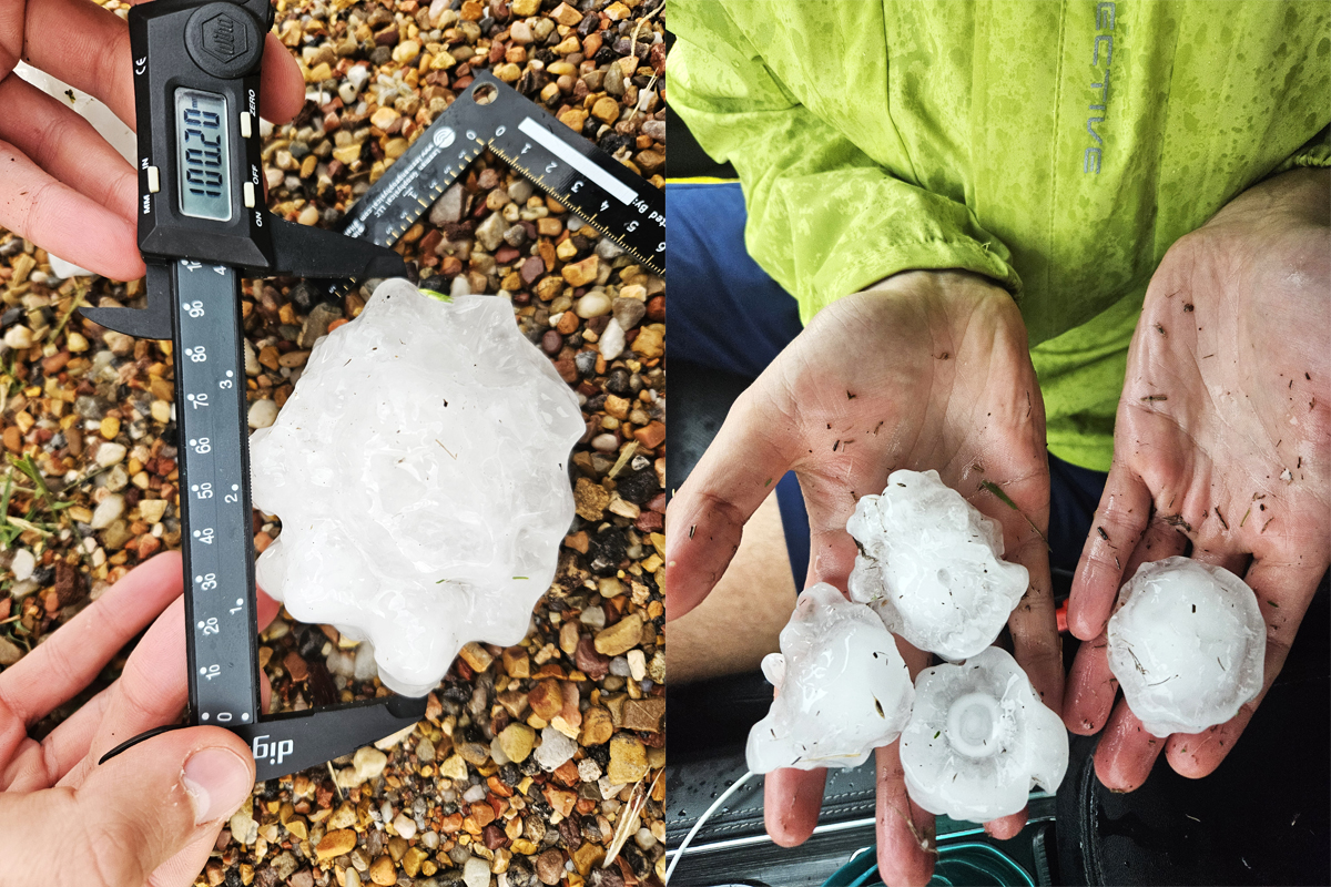
Current methods of hail prediction particular challenges when it comes to large hailstones. So far, it has been difficult to determine hail size from radar-based observations. Additionally, there is a lack of observations regarding the shape and density of hailstones, as well as how these characteristics change throughout a hailstorm. These factors are highly relevant to the impact of hail.
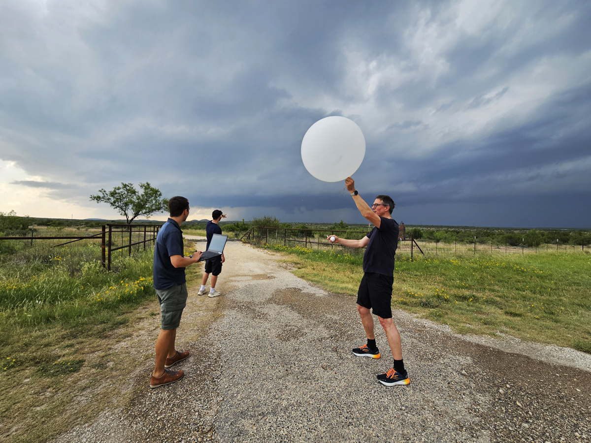
ICECHIP aims to address these gaps. Using advanced measurement technology and numerical modelling, the campaign seeks to mark a milestone in hail research. Mobile radar systems, unmanned aerial vehicles, balloon sondes, laser scanners, high-resolution cameras, as well as traditional methods for measuring atmospheric conditions and hail size at the ground level will be used. Over six weeks, mobile measurement teams with more than 40 vehicles will operate across the Great Plains to capture a wide range of hailstorms.
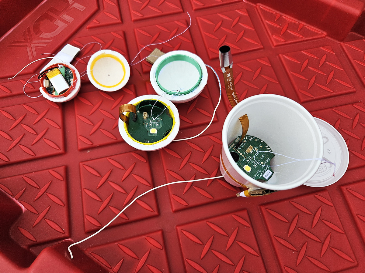
The ‚Atmospheric Risk‘working group participates in ICECHIP, conducting targeted measurements to investigate updraft structures and hail trajectories within thunderstorm systems. For this purpose, so-called hail sondes are launched into the updraft zones of thunderstorms using balloons. This enables the strength of the updraft and the potential trajectories of hailstones to be determined (Soderholm et al., 2025). Additionally, drone flights are carried out over hailstones on the ground (Soderholm et al., 2020). These measurements aim to improve our understanding of the physical processes involved in hail formation and its distribution on the ground. This knowledge will be used to improve short-term hail forecasts (known as nowcasting) and reduce the potential damage caused by hailstorms or more accurately estimate it. These investigations form part of the larger DFG research project, LIFT (Understanding Large Hail and Trajectories), at IMKTRO.
References:
Soderholm, J. S., Kumjian, M. R., McCarthy, N., Maldonado, P., Wang, M. (2020): Quantifying hail size distributions from the sky – application of drone aerial photogrammetry, Atmos. Meas. Tech., 13, 747–754, doi:10.5194/amt-13-747-2020.
Soderholm, J. S., Kumjian, M. R., Brook, J. P., Peterson, A., Protat, A., Brimelow, J., Trömel, S., Kunz, M. (2025): Measuring hail-like trajectories and growth with the Hailsonde. Bull. Bull. Am. Meterol. Soc. (in review).
Witze, A. (2025): Why do hailstones get so big? Scientists are chasing storms to find answers. Nature News, doi:10.1038/d41586-025-01618-7.
[Working Group: Atmospheric Risks]
Authors: Susanna Mohr, Elias Hühn, Jannick Fischer, Michael Kunz (May 2025)