
How does the wind blow above a mountain range?
Weather forecasting and meteorological research need precise measurements. On the one hand, numerical weather models depend on correct input, on the other hand, their evaluation and improvement can only be achieved with precise and high-resolution measurements. Wind in particular plays an important role, as it is a decisive parameter for many phenomena. To date, however, wind measurements are only available at few locations and often only close to the ground. Thus, especially in complex flow situations such as in mountainous areas, the spatial variability of the wind field can so far only be measured inadequately.
In order to obtain spatially resolved wind measurements, the IMK-TRO is developing an airborne Doppler lidar in cooperation with the University of Braunschweig for use aboard their Dornier 128-6 research aircraft (Fig. 1a).
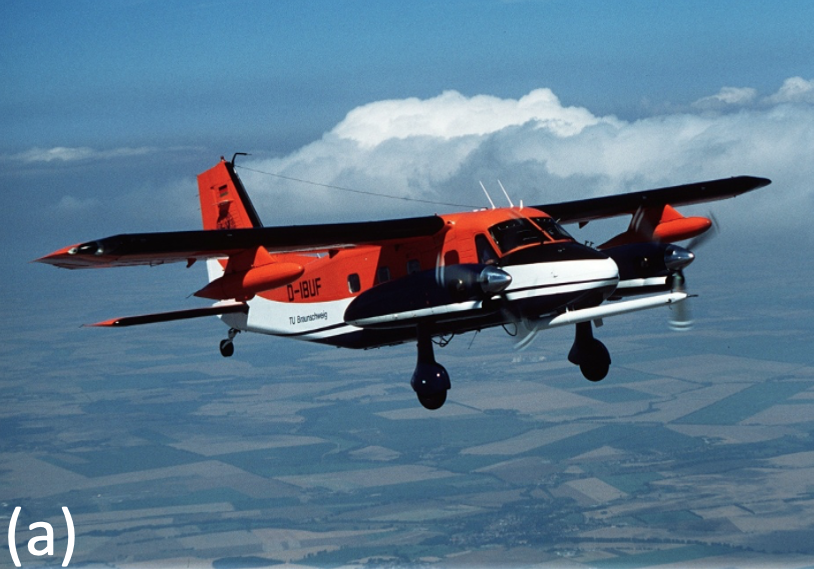
@IFF TU-Braunschweig
The Doppler lidar (Fig. 1b) allows for remote sensing of the wind field up to a range of 10 km with 10 Hz resolution, making it one of the most powerful systems available. It is based on a WindTracer WTX, which already proved its high performance during ground-based measurements campaigns of KITcube. The use of the Doppler lidar on the research aircraft now allows to carry out high-resolution measurements of the wind field over larger areas.
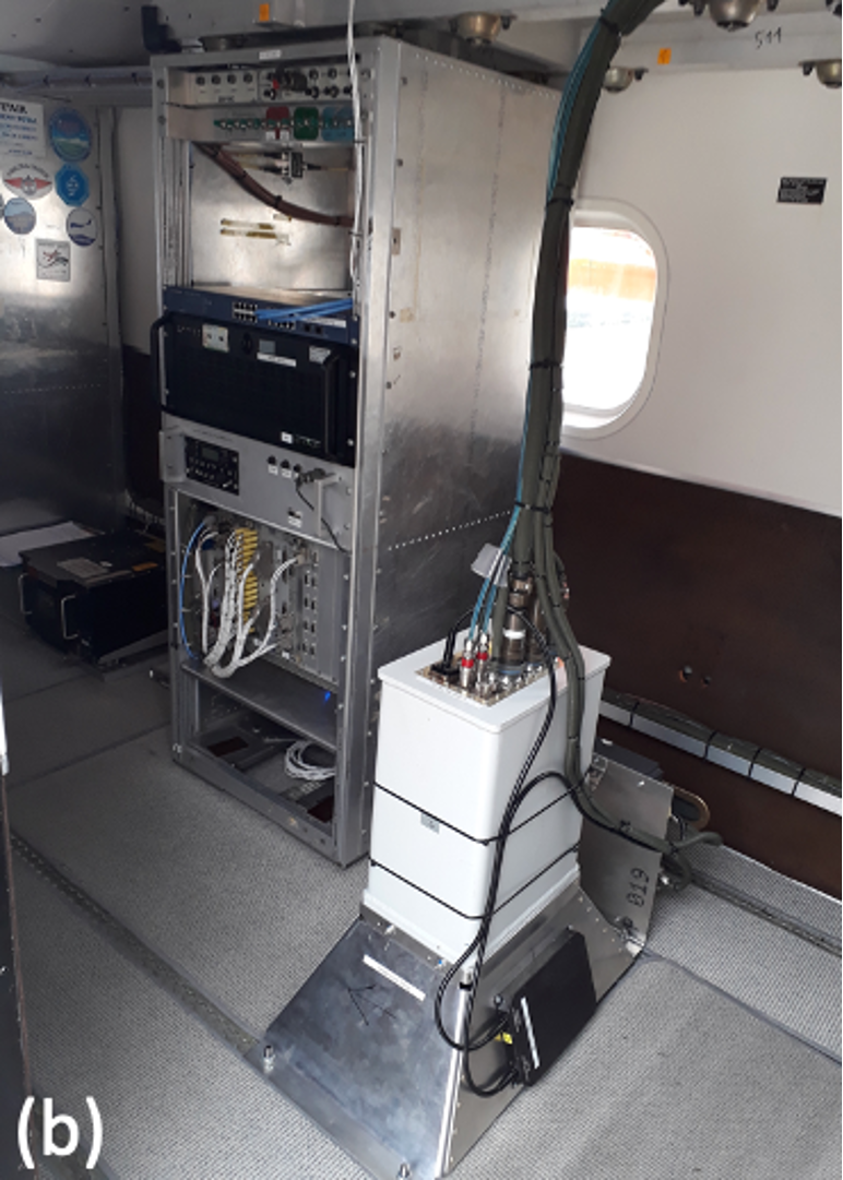
@Philipp Gasch
The implementation on the Dornier 128-6 aircraft is particularly advantageous for measurements in complex terrain. Thanks to its flexibility and low speed, the new system offers a much higher spatial resolution than systems on jet aircraft, at lower operating costs. The operation under visual flight rules in the lower airspace enables measurements in the atmospheric boundary layer - the area of the atmosphere that is in exchange with the ground and in which our daily lives take place. Turbulent transport processes in this layer are of highest importance but particularly complicated for models and observations.
For initial measurements, a test version of the airborne lidar, without a scanner, was installed in the aircraft and pointed downwards through an opening in the cabin floor. This configuration allows to measure the vertical wind (updrafts and downdrafts) in straight flight and the horizontal wind in turns. Thus, the system delivers previously unavailable insights into the wind field with high resolution and accuracy.
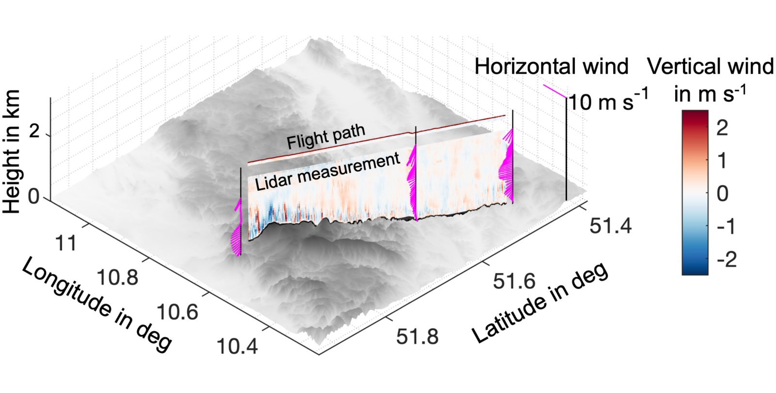
Figure 2 shows an example of a flight over the Harz Mountains. The lidar measures the vertical wind on a curtain below the flight path every 7 meters. Below the free troposphere, where low vertical wind speeds prevail, the turbulent boundary layer with individual stronger updrafts as well as larger-scale, weaker downdraft structures is visible. The influence of the mountains on the height and strength of the updrafts is clearly observable thanks to the spatial coverage of the aircraft lidar. The vertical profile of the horizontal wind also shows significant spatial differences. This case is typical for a developing boundary layer in the morning.
©Philipp Gasch
As part of the "Swabian MOSES" measurement campaign, the airborne lidar will be combined with a new 2-axis scanner. Flow processes in thunderstorm environments can then be investigated with a high degree of detail. This allows to serve and validate the latest generation of high-resolution weather models with suitable measurement data in the future.
References:
Gasch, P., Wieser, A., Lundquist, J. K., & Kalthoff, N. (2020): An LES-based airborne Doppler lidar simulator and its application to wind profiling in inhomogeneous flow conditions. Atmospheric Measurement Techniques, 13(3),1609-1631, https://doi.org/10.5194/amt-13-1609-2020
Links to corresponding web sites:
KITcube – the advanced integrated atmospheric observation system
https://www.kitcube.kit.edu
The research aircraft Dornier 128-6
https://www.tu-braunschweig.de/forschungsflugzeug
The Doppler lidar system and its measurement principle
http://www.imk-tro.kit.edu/7862.php
Working Group: "Land Surfaces and Boundary Layer"