
State-of-the-art data bases to advance understanding on extreme weather
As a result of global warming, the type, frequency and intensity of extreme events are expected to rise. Changes in some types of extreme events have already been observed, for example, increases in the frequency and intensity of heat waves and heavy precipitation events. These changes will be more drastic in certain areas of the globe. The Mediterranean regions have been identified as one of the two main “hot-spots” of the climate change.
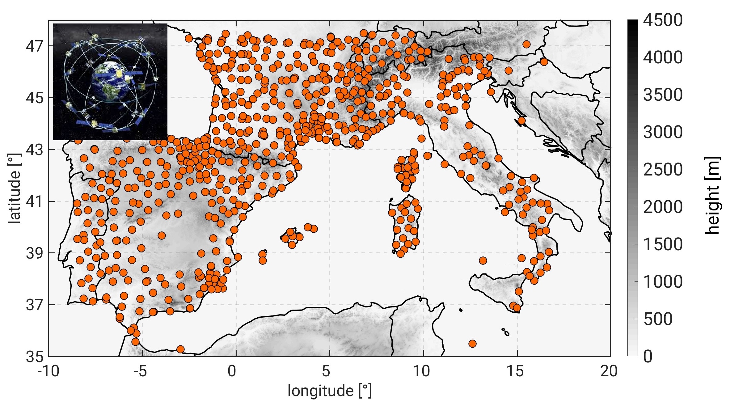
The capability to predict such dramatic events is still a great challenge. Despite the significant progress made in terms of climate monitoring as well as weather and extreme event forecasting during recent years, many uncertainties remain. Further improvements now depend to a large extent on the availability of high spatial-temporal resolution global observations of crucial variables such as soil water content and atmospheric water vapour. State-of-the-art space missions, such as the European Space Agency (ESA) Soil Moisture and Ocean Salinity (SMOS) mission, together with the use of new technologies, such as Global Positioning Systems (GPSs) could fill this gap. The SMOS mission provides a unique data set of global measurements of surface soil moisture already successfully downscaled to 1 km horizontal resolution. Additionally, as part of HyMeX (Hydrological Cycle in the Mediterranean Experiment) efforts an exceptional data set of GPS measurements together post-processed with a 10-minute frequency is available.
| Figure 1: Position of GPS stations from several European networks, jointly post-processed to offer a unique merged product with a 10-minute frequency in the framework of HyMeX. |
In the framework of the BMBF founded PREMIUM (Predictive models for Extremes and High Impact Weather under Climate Change) project the Junior research group “Extreme weather in a changing climate” exploits an innovative approach by using the synergy of the above described state-of-the-art high-spatial resolution data sets for initialization and assimilation in the high-resolution convection-permitting regional climate modelling system COSMO-CCLM across spatio-temporal scales, from days to decades temporal scale and up to 500 m resolution. Our purpose is to fill some knowledge gaps and reduce uncertainties improving the modelling and understanding of climatic and weather extremes and the responsible mechanisms.
First results already reveal the benefit of using the newly released data sets; an improved representation of extreme weather and a better understanding of the processes shaping these phenomena due to the higher spatio-temporal resolution of the available observations support this fact.
For more information please visit our web-page: http://www.imk-tro.kit.edu/english/6760.php
[Working group: Extreme Weather in a Changing Climate]